Tetouan Tourist Map
Explore the city with our Tetouan tourist map, listings for the sights, hotels and other attractions
Free Tetouan Tourist Map in PDF
What's on the Tetouan Map
The map covers the UNESCO-listed medina - the most authentic in northern Morocco - Hassan II square and the Royal Palace, the Spanish-built Ensanche with its white Andalusian facades, the archaeology and ethnographic museums and the crafts school (Dar Sanaa).
Tetouan sits on the slope of Jbel Dersa: the Ensanche and the medina meet at Hassan II square, which makes the perfect starting point - white new town on one side, whitewashed old town on the other.
Tips for Using the Map
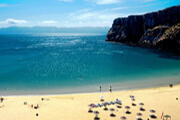
The medina is genuinely local - few signs, few tourists - so keep the PDF offline and note your entry gate. The beaches of Martil and M'diq are 10 to 15 km away, an easy grand taxi ride.
Plan your visit: our Tetouan city guide.
Frequently Asked Questions
Is the Tetouan map free to download?
Yes. The Tetouan map is a free PDF - download it to your phone for offline use or print it before your trip. No sign-up is needed.
Is Tetouan worth visiting?
Yes - its medina is UNESCO-listed and far less touristy than Fes or Marrakesh, the Spanish Ensanche is unique in Morocco, and the Mediterranean beaches of Martil and M'diq are minutes away.
How do I get to the beaches from Tetouan?
Martil (the closest, 10 km) and M'diq (15 km) are quick grand taxi or local bus rides from the center - both make an easy afternoon by the sea after a morning in the medina.
Related articles : Map
Advertisement